This relatively easy trek is a wonderful introduction to the Annapurna mountain region starting in Pokhara, on the shores of picturesque Lake Phewa. The trek is one of contrasts between the green, terraced farmland of the Marshyangdi valley and the semi-arid environs of Lower Mustang. The two areas are separated by the Thorong La River (5416m), which we must cross on a long day, to reach the sacred site of Muktinath.
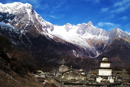
The temple complex is a pilgrimage site for both Hindus and Buddhists and when seen from here the sunrise on Dhaulagiri is particularly striking. We descend into the world's deepest river gorge, carved by the mighty Kali Gandaki, as it slices between the Annapurna and Dhaulagiri massifs. The river meanders to the relaxing hot springs at Tatopani before ascending to Poon Hill for our last sunrise over the Annapurnas.
Day 01 :Arrival at Kathmandu
Upon arrival at Kathmandu International Airport transfer to your hotel in Kathmandu or Bhaktapur. A short briefing will follow concerning the necessary formalities and your Annapurna Circuit trek itinerary. Depending upon your arrival time you may spend free time visiting nearby sanctuaries or resting.
Day 02 : Sightseeing / Cultural Day in Kathmandu Valley
Half day sightseeing around UNESCO Bhaktapur / Kathmandu where your guide will escort you on a tour of Buddhist and Hindu temples and shrines reflecting ancient local traditions. There is time to explore the city's many places of interest on your own or take a rest while trekking permits are finalised. In the evening sample a delicious traditional Nepali dinner.Overnight in Kathmandu.
Day 03 :Kathmandu to Besi Shahar (830m)
Kathmandu to Besi Shahar (830m) Breakfast. Our trekking guide will come to the hotel at 07:00 hrs to pick you with private transport to leave for Besi Shahar (185km) and will take us about 6 hours. Along the journey you will witness some spectacular scenery of white mountains, green hills, rivers and hamlets. We overnight at a guesthouse.
Day 04 :Besi Shahar to Bahundanda (1430m)
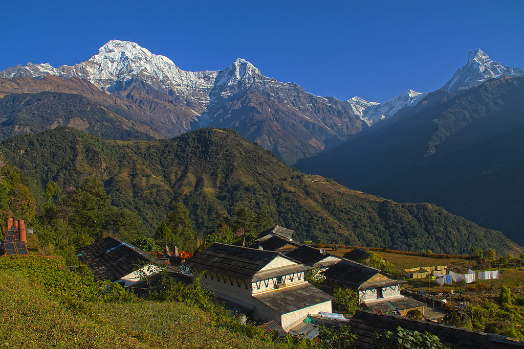
Our first day's trekking introduces us to the diverse cultural elements of Nepal and we pass by many typical local houses and the faces of varied ethnic tribes exchanging greetings (Namaste) as we pass. We will share the trail with mule caravans that transport supplies to the remote villages. Our route makes its way through subtropical forests and the rice terraces of Sera to the village of Khudi (840m). After we pass the village of Bhulbule we will see a majestic 60m high waterfall. Along the way we have views of Manaslu (8156m). The mountain views disappear as we come closer to the small town of Ngadi, here we will have to cross the Ngadi Khola by a long suspension bridge. From here on the trail moves gently upwards to Bahundanda, an attractive village in the saddle of a long ridge at 1300m (7 hrs).
Day 05 :Bahundanda to Chamje (1410m)
We start the day by descending on a steep slippery trail past amphitheatre-shaped rice terraces. There will be a small hot spring after this descend. The rest of today's trek will have us pass the river a few times and we will see a few waterfalls as well. As we near the village of Jagat we will have a steep 200m climb to a trail that has been blasted out of the rock face. 15 minutes below this village we can visit another small hot spring. From Jagat we climb up to Chamje (6 hrs).
Day 06 :Chamje to Bagarchhap (2160m)
Today we will do the 940 meter ascent to Bagarchap through bamboo and rhododendron forests, on a trail high above the river bank. We will pass the village of Tal at 1700 meter which lies at the foot of a large waterfall. The trail crosses a broad, flat valley that was once a lake (Tal means lake) after which we will cross the Marsyangdi by a 60 meter long suspension bridge. The trail will climb up from a second suspension bridge to a stone kani (an arch over the trail) which marks the entrance to Dharapani at 1960 meter. All old villages from here to Kagbeni have these arches and they become more elaborate and picturesque as the Tibetan influence becomes stronger. The trail slowly climbs from here on through a forest of blue pine, spruce, hemlock, maple and oak to Bagarchhap. This is the first village on the trek with typical Tibetan architecture: closely spaced stone houses, with flat roofs piled high with firewood. (7 hrs).
Day 07 :Bagarchhap to Chame(2170m)
We will first follow the south bank of the river climbing to Syal Khola (the river of jackals) at 2210 meter, after which we will cross the river over a cement bridge near a spectacular waterfall. The route crosses several landslides as it works its way uphill through a walnut tree forest and aside apple orchards until we arrive at Chame. At the entrance of the village is a long wall with many prayer wheels. Throughout the day there are nice views of Lamjung Himal, Annapurna II and Annapurna IV (7525m) (6 hrs).
Day 08 :Chame to Pisang (3190m)
We will first pass the older part of Chame and climb up to Telekhu at 2840 meter and continue with a long pleasant and mostly level walk through the forest to Brathang, which lies at 2950 meter. After the trail rounds a bend here we will see the first view of the dramatic Paungda Danda rock face, a tremendous curved slab of rock rising more then 1500 meter from the river. We will cross back to the south bank of the Marsyangdi on a suspension bridge at 3080 meter and then make a long gentle climb over a ridge through blue pine forests. After this the trek will be reasonably level as it heads to the upper part of Manang valley to Pisang. This town marks the beginning of the region known as Nyesyang, the upper portion of the Manang district (5 hrs).
Day 09 :Pisang to Manang (3540m)
Today our trek will slowly climb up to the Tibetan-style village of Bryaga at 3500 meter following the valley floor. At Bryaga we will see houses stacked one atop the other, each with an open veranda formed by a neighbours rooftop. The gompa, perched on a high crag overlooking the village, is the largest in the district and has an outstanding display of statues. We then continue through a very arid countryside, dominated by weird cliffs of yellow rock, eroded into dramatic pillars alongside the trail to reach today's destination, the village of Manang, where the shops are surprisingly well stocked with all the things you might want to refuel on (5 hrs).
Day 10 :Manang.
Today we stay in Manang where we can do a short hike to ascent slightly higher to for instance Khangsar, which is a 200 meter ascend. It is important to have a relatively restful day today, to allow your body to acclimatize to the higher altitudes and thinning air. It also gives us the possibility to wash some of our clothing.
Day 11 :Manang to Letdar (4250)
Trekking slowly upwards to Thorung La we will leave the large trees behind and see vegetation consisting mainly of scrub juniper and alpine grass and we will pass a few meadows where horses and yaks graze. After we reach Yak Kharka we will see herds of blue sheep grazing the steep slopes as well. About an hour after passing Yak Kharka we will arrive at Letdar.
Day 12 :Letdar to Thorang Phedi, or Thorang High Camp
Again a relatively easy day to get used to the altitude before we have to cross the highest point in the trek, and possibly the highest point you have been on in your life. From Letdar we will continue to climb along the east bank of the Jarang Khola to Thorung Phedi, a rock-strewn meadow surrounded by vertical cliffs at 4420 meter. Blue sheep and even snow leopards can be sometimes seen in this valley. High in the skies above us we can see lammergeyers and Himalayan griffons circling around (3-4 hrs).
Day 13 :Thorang-Muktinath (3800m) via Thorang La Pass (5416m)
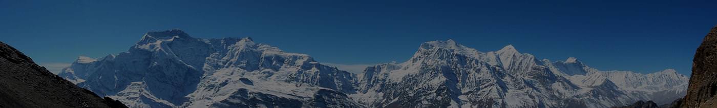
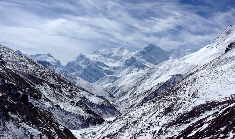
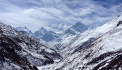
Today is a long trek starting before sunrise at maybe 04:00 hrs to reach the pass by 09:00/10:00 hrs at the latest, as otherwise weather At the Thorung La pass, with its traditional prayer flags and stone cairn we will have outstanding views. You can see the Annapunas, Gangapurna and Khatung Kang, a heavily glaciated peak. Amazingly there is a teashop here on top of the pass at 5416 meter. From here we start a long descend of about 1600 meter with outstanding views of Dhaulagiri mountain standing alone in the distance across the valley. After the trail becomes less steep we will enter grassy fields and cross meadows to our final destination of Muktinath, which means place of Nirvana and is home to the Muktinath temple as well as several monasteries. It is said that all sorrows you feel are relieved when visiting the Temple, which is a scared pilgrimage site to both Hindus and Buddhists. The main pilgrimage normally takes place in September. The Temple is dedicated to Lord Vishnu and has 108 waterspouts around it from which Holy water pours. Another attraction nearby is the Jwala Mai Temple and this contains a spring and an eternal flame fed by natural underground gas (9 hrs).conditions will greatly affect the journey. We cross over at an altitude of 5416m so can be exposed to strong winds if crossing too late. Local people have used this trail for hundreds of years to bring herds of sheep and yaks in and out of Manang. Thus the trail, while often steep, is well defined and easy to follow. Snow can block the pass at any time of the year if there has been an unseasonable storm. It takes from four to six hours from Thorung Phedi to the pass, but the many false summits mean the climb seems to go on for ever.
Day 14 :Muktinath to Marpha via Jomsom (2665m)
From today we will follow the Jomsom trek in reverse order. We will first go down to Kagbeni, which is a 990 meter descend through meadows, streams and fruit trees like peach orchards. Then we will continue going down to Jomson (more correctly Dzongsam, or new fort). Our descend continues through the Kali Gandaki Valley to Marpha. Marpha is home to many apple orchids as well as all the various food products made from the fruit. Apple Brandy is a local specialty that you may be lucky enough to taste en route (6 hrs).
Day 15 :Marpha to Ghasa (2080m)
This day will be a rewarding day when we trek further down the Kali Gandaki valley alongside the Kali Gandaki river to Ghasa. We will pass the villages of Tukuche at 2580 meter and Larjung at 2560 meter. We then cross the the Kali Gandaki river by a high suspension bridge and continue through an area covered with fir, juniper and cypress trees. Towards the village of Kalopani (2530m) we will have splendid 360˚ views of Dhaulagiri, Tukuche Peak, the three Nilgiris, Fang and Annapurna I. After crossing another very long suspension bridge (107 meter long) we will reach Ghasa, our base for this night (6 hrs).
Day 16 :Ghasa to Tatopani (1190m)
Today our trek leads us through the steepest and narrowest part of the Kali Gandaki valley; much of the way is cut through solid rock and subject to frequent landslides. Before we reach the village of Dana (1450m) we pass the Rupse Chhahara (beautiful waterfall). Descending further down past several landslides we will reach Tatopani, meaning hot water, which is situated on the riverbanks where we will stop to make the most of a well deserved hot bath (5 hrs).
Day 17 :Tatopani to Ghorepani (2834m)
Leaving the hot springs behind us we have a day of climbing ahead of us to Ghorepani. We leave the Kali Gandaki valley and we will follow the Ghar Khola river and cross this river on an old swaying bridge. We will continue ascending to Ghara (1780m) and Shika (1935m) where there still is a British army training centre. The last part of the trail today will have us climbing through rhododendron and magnolia forests to Ghorepani, where we will arrive mid afternoon (7 hrs).
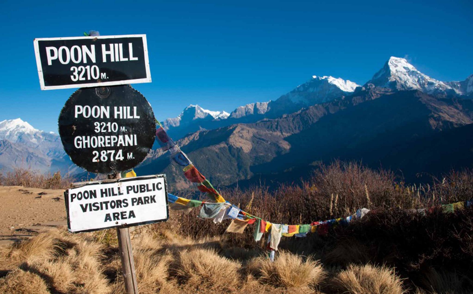
Day 18 :Ghorepani (2834m) to Poon Hill (3210m) to Tadapani (2520m)
An early start and an hours hiking to Poon Hill (3195m) leads us to a brilliant spectacle, this viewpoint provides an unobstructed beautiful sunrise over the high Himalayas. After spending about 40 minutes on the hillside, we come back to Ghorepani for a hot breakfast, and start walking to Tadapani. From Ghorepani the trail climbs along ridges and through pine and rhododendron forests and if the weather allows it we have a panorama all the way south to the plains of India. The trail follows a stream bed which becomes larger as we continue. The stream has some clear pools alongside the trail and finally becomes a series of waterfalls. Today's final destiny is the village of Tadapani, meaning "far water" and the water supply for this village is a long distance below (5 hrs).
Day 19 :Tadapani to Ghaundrung (1950m)
The Ghaundrung trail descends steeply through forests to the village of Ghaundrung where we will arrive around noon. We will overnight here so have the afternoon to visit the Annapurna conservation office and museum. As well as take time to explore this maze like village (3 hrs).
Day 20 - 21 :Ghaundrung to Pokhara via Pothana (1910m) and Phedi (910m)
Our last two days of trekking on the Annapurna Circuit take us through the village of Pothana (2110m) before reaching Phedi (950m). On arrival in Phedi, mid morning, our private transportation meets us before driving to Pokhara.
Day 22 :Fly or drive back to Kathmandu
Fly or drive back to Kathmandu.
Day 23 :Kathmandu Departure day
Departure to Destination from Kathmandu.
Cost includes:
Pick up from airport transfer to the Hotel stay overnight at Hotel
One full day guided tour in Kathmandu
Three Night accommodation in Kathmandu (two night before trek /one night after trekking
Annapurna National Park area entry permits
Tims card (Trekking information management system )
Kathmandu to Besi-sahar(trekking starting point) - (trekking ending point) pokhara to Kathmandu By Bus
A guide: English speaking,registers, insurance food accommodation, salary
We provide you three meals a day breakfast/lunch/dinner tea or coffee
Accommodation in the mountain at lodge/tea houses
Purified safe drinking water
First aid kit box services
Trekking registration in concern at diplomatic office in Kathmandu
Emergency co-operation services
Applicable taxes
Hotel to airport transfer by private car for fare well departure.