A copy of Passport & 2 Passport size Photographs are required to issue the TIMS Card and Trekking Permit as well Conservation Area Permit for Trekking in Nepal
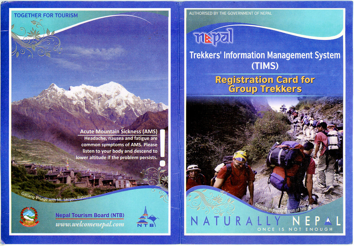
For safety all trekkers in Nepal must acquire the Trekkers’ Information Management Systems (TIMS) Card before trekking. TIMS Card is mandatory to ensure the safety and security of trekkers in the general trekking areas.
TIMS Card fees are as follows –
For Foreigner:
Group trekker:Nepali Rs. 1,000 (About US dollor Ten) per trekking route per person per entry.
Individual Trekkers: Nepali Rs. 2,000(About US Dollor Twenty ) per trekking route per per person per entry.
For SAARC Countries:
Group trekker:Nepali RS. 300 (About US Dollor Three) per trekking route per person per entry.
Individual Trekkers: Nepali Rs. 600 (About US Dollor Six) per trekking route per per person per entry
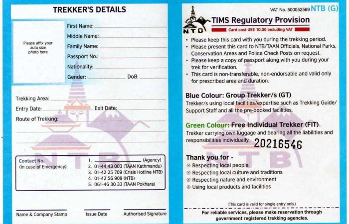
The follwing details should be provided to obtain TIMS CARD.
1. passort size Photograph
2: Personal Details:
FIRST NAME:
MIDDLE NAME:
Family Name:
Passport No :
Gender:
Date of Birth:
Nationality:
Note:
Diplomats are not charged for the Tims Card.
Park entry permit must be obtained to enter Annapurna Conservation Area.
Per person per entry:
For Foreigners : Nepali Rupees 3,000 (About US dollor thirty)
For SAARC Countries : Nepali Rupees 1,000 (About US dollar Ten)
For Nepali: Nepali Ruppes 100 (About US dollar One)
The follwing details should be provided to obtain Annapurna Conservation Area Permit:
1. Passport Size Photograph
2. Persoanl Details
FIRST NAME:
MIDDLE NAME:
Family Name:
Passport No :
Gender:
Date of Birth:
Nationality:
Child Discournt: Below 10 Years free of cost
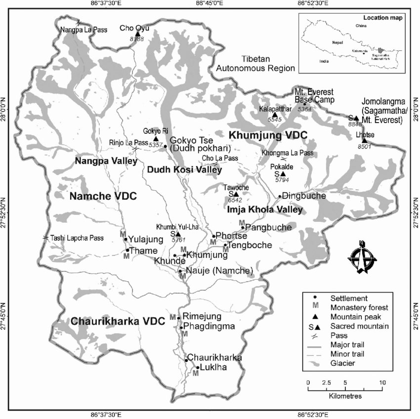
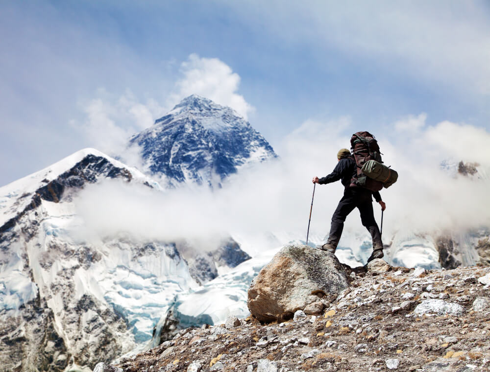
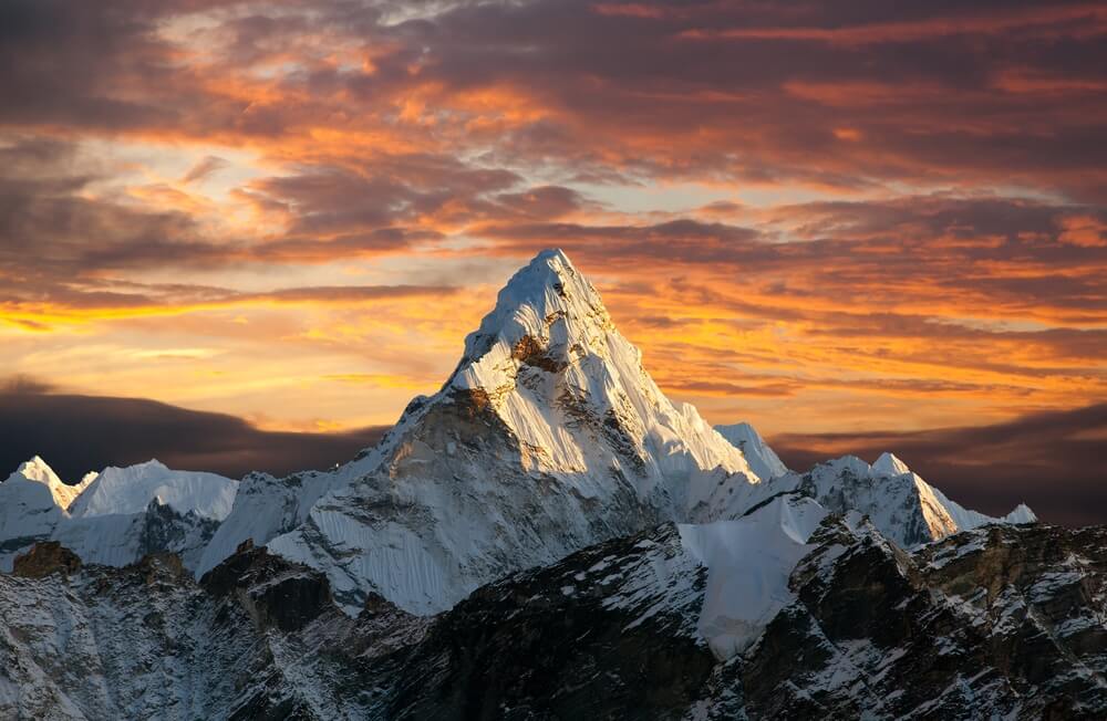
Encircled by mighty Mount Everest, and other peaks, deep ravines, and Himalayan glaciers; Sagarmatha National Park is one of the most scenic masterpieces on Earth, located in north-east Nepal. Nestled at a distance of 135 km from Kathmandu, this national park is listed as a World Heritage Site by UNESCO and one of the Sacred Himalayan Landscapes. From flora, fauna to spectacular landscape, every aspect of nature’s charm is preserved here.
Established in 1976, Sagarmatha National Park is located in Khumbu region of Nepal. It is the first national park of Nepal. Encompassing an area of 1148 sq. km, this bioreserve ranges in altitude between 2845-8848 m. Sagarmatha National Park is bordered by Qomolangma National Nature Preserve of Tibet Autonomous Region in the north and Dudh Koshi River in the south. Sagarmatha National Park became a natural World Heritage Site in 1979.
The climate at Sagarmatha National Park varies between semi-arid subtropical to temperate type, with medium to heavy annual rainfall. Summer months are moderate, whereas July to September record heavy precipitation. Winter months are extremely cold and temperature drops below freezing point.
The best time to visit is from October-November and March to May. June to September should be avoided as the place receives heavy rainfall, approximately 1000 mm and makes it difficult for hiking and camping. Winter months starting from December to February are extremely cold and snowfall is common in these months.
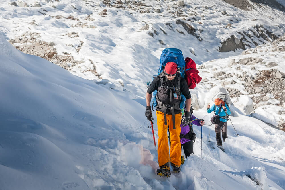
Sagarmatha National Park enjoys a remote location and accessibility is quite a challenge. The nearest air connect is at Tenzing-Hillary Airport, Lukla- which is 33 kms away. The best and easiest way is to fly to Kathmandu and then take a short flight (25minutes) to Lukla. From Lukla, one can trek up to the national park. The trail is steep, rugged yet extremely exciting.
|
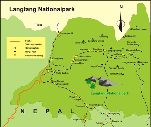
Langtang National Park: Details, MAP and Permit Fee |
|
Langtang is one of the most unspoiled national parks of Nepal. Situated North of Kathmandu, it is the most easily accessible highland sanctuary from the capital. Langtang covers 1,710 sq. km. forming the upper catchment areas of two of Nepal's largest river systems - the Trishuli and Koshi. There is great latitudinal variation, starting at 1,500 m. and ascending to the top of Mt. Langtang Lirung at 7,234 m. As a result the park has immense ecological diversity. Some of the most attractive areas of the park include the Langtang Valley, the holy lakes at Gosainkunda, and the forested hillsides above the village of Helambu. The deep gorges of Bhote Koshi and Langtang Khola are thickly forested with rhododendron, oak, maple and alder. The stretch of forest around Ghoda Tabela in the lower Langtang Valley and below Gosainkunda is inhabited by the red panda, a rare and threatened symbol of a healthy Himalayan ecosystem. Other animals, common to these forests are wild boar, Himalayan black bear, ghoral, grey langur monkey and leopard. The rare Himalayan hony guide has been sighted here and the park is also the home for Impeyan, Tragopan and kalij pheasants among others. Larch, a rare deciduous conifer, is also found in the forest of lower Langtang Valley. Further up, Himalayan tahr, musk deer and snow leopard can be found. The upper Langtang Valley is one of he few known breeding grounds of the ibils bills besides the Tibetan snow cock and snow partridge. Like other Himalayan nature parks, Langtang has to be explored on foot. There are several possible trails to choose from depending on preference and time available. The langtang Valley is easily approached from Dhunche town and park office, which is a day's drive from Kathmandu. The upper reaches of Langtang can be reached in four days of easy walking, however, it is advisable to spend a few days around the forest at Ghoda Tabela to watch for the red panda. Once above Langtang village and the monastery at Kyangin, visitors can explore the high valley of Langshisa Yala peak and Tsero, Ri. These and other villages of upper Langtang are inhabited by people of Tibetan descent whereas the villagers of Dhunche, Bharkhu and Syabru further down are home to the Tamangs of Nepal's middle hills.
FEATURES
FLORA AND FAUNA Langtang's expansive high meadows provide summer habitat for numerous ungulate species such as musk deer and Himalayan tahr. The park is also well known for its populations of red panda, Himalayan black bear, snow leopard, wild dog, ghoral, serow and more than 250 species of birds. The park also offers a rich cultural diversity. The three main ethnic groups in LNP are the Tamang, Yolmo, and Bhotia. Each thought to have originated from Tibet. The cultures are discernible by language, house style, dress ornaments, and customs. The tamangs are traditional framers and cattle herders of the region. Their religion is related to the Bon and pre Buddhists doctrines of Tibet. While the people of langtang valley are mostly bhotias with recent Tibetan origin. Many have intermingled with local tamangs. The yolmo people of the Helambu region are often referred to as “ Sherpa”. However, their language and socio-cultural set up donot resemble the Solukhumbu Sherpa. They are rather more akin to Langtang Bhotias and may also have migrated from the Kyirung area of Tibet. Other hill tribes and castes such as Brahmins, chhetri, newar and gurung inhabit the lower elevational range along the edges of the park.
CLIMATE
PLACES OF INTEREST Trekkers who take extra time to explore trailside wilderness (e.g. near Ghora Tabela and Kyanjin) hill top view point (Kyanjin), and cultural sites (notably in Langtang village and Melamchighyang. Tarkeghayang and Shemathang) will be well rewarded. One has to be self sustaining to venture remote areas of the Park such as Panch Pokhari (five lakes), east of Helambu, the toe of Langshisa glacier, and upper level valley from Kyanjin: and over the challenging Ganja La pass in upper Langtang Valley.
ACCLIMATIZATION AND SAFETY Over exertion and dehydration contribute to HAS. Drink at least 3-4 litters of water everyday besides tea and coffee which act as diuretics. Watch the health of your companions and porters. Symptoms of HAS are headache, dizziness, trouble in breathing and sleeping, loss of appetite, nausea and general fatigue. If someone develops HAS symptoms, take the person to lower elevation immediately. The Langtang-Helambu trails are rocky and slippery after rain or frost. Watch out for falling rocks while crossing landslides but do not stop. Never hike alone. Hiring local guides is strongly recommended on Ganja La (5120m) trek and on Lauribina La (4600m) during winter. Carrying a comprehensive first-aid kit is advisable as there are no medical facilities out of Dhunche. Telephone facilities are available at Singh Gompa and at major settlements in Helambu. |
Langtang Nation park Entry Fee:
For Nepali People: Nepali Ruppes 100 ( About US dollor One) per person per Entry
For SAARC Countries : Nepal Ruppes1,500 (About US dollor Fifteen per person per entry
For Foreigner: Nepali Ruppes 3,000 (About US dollor Thirty per person per entry
Child Discournt: Below 10 Years free of cost
Where to get the permit and to Pay: DNPWC Counter, Nepal Tourism Board, Bhrikutimandap, Kathmandu and At entry point in Dhunche
National Park Fee will be required to trek in major areas such as:
| Destination | Fees | Region | ||
| Sagarmatha Nationa Park (Everest Trek) | NPR. 3000.00 | Everest | ||
| Langtang National Park (Langtang Trek) | NPR. 3000.00 | Langtang | ||
| Annapurna Trek , (ACAP) | NPR. 3000.00 | Annapurna Area | ||
| Manaslu Trek, (MCAP) | NPR. 3000.00 | |||
| Kanchanjunga and Lower Dolpa | USD 20.00 per week per person |
|
||
| Shivapuri National Park (Nagarkot Trek) | NPR. 1000.00 | Around Kathmandu | ||
| Sheyphoksundo National Park | NPR. 3000.00 | Lower/Upper Dolpa |
Special Trekking permit is required to visit Nepal´s restricted areas determined for trekking by the government. If you plan to trek in two different areas, two trekking permits are required.
| Destination | Fees | Area/Region |
| Upper Mustang | USD 500.00/10 days/per person | Mustang/Annapaurna |
| Upper Dolpo | USD 500.00/10 days/per person | Upper Dolpo |
Note: After 10 days US$ 50.00/per day per person for upper Dolpo and upper Mustang.
Manaslu Trekking Permit:
September-November: USD 100.00 for 7 days per person and after 7 days USD 15.00 per person.
December-August: USD 75.00 for 7 days per person and after 7 days USD 10.00 per person.
ACAP (Annapurna Conservation Area Project) Entrance Permit. NPR. 3000.00 per person
MCAP (Manaslu Conservation Area Project) Entrance Permit. NPR. 3000.00 per person
Tsum Valley Trek:
September-November USD 40.00 / person / week. USD 7 per day after one week
December-August USD 30.00 / person / week. USD 7 per day after one week.
Nar Phu Valley Permit
September - November USD 100.00 per week per person and December - August US$ 75 per week per person. USD 15 per person / day (beyond 1 week)
Dolakpa District (Lamabagar Ward No.1 (Lapchi Village) Gaurishanker Ward No. 1 (Beding 9 and Chhorolpa Lake area):
Per week per person USD 20.00
Humla District (Simikot-Yari):
Areas of Limi and Muchu VDC, area way to Tibet via Tangekhola of Darma VDC.
First 7 days: USD 50.00 and after 7 days: USD 10.00 per day per person
Kanchanjunga and Lower Dolpa:
USD 20.00 per person per week.
Notes: To get group trekking permit an application form with other relevant documents should be submitted through registered trekking agency of Nepal and Trekking fee can be paid in Nepalese currency. As for new rules, new trekking pass TIMS (Trekkers´ Information Management System) card is required for trekking in all major areas along with National Park entrance permit. Which is costs: USD 10.00/per person.